Scaling Space and Time. The Production of Global Climate Knowledge in the 19th and 20th Centuries
Knowledge about the climate, about anthropogenic climate change and its effects on the environment characterizes today's debates. However, the understanding of climate and by whom it was understood changed considerably in the course of the 19th and 20th centuries. Climate was not only an important topic of scientific debate, but also part of political, economic, colonial and medical discourse... more
Image: Hermann Berghaus/Julius Hann, Jahres-Isothermen, in: Hermann Berghaus (ed.), Berghaus' Physikalischer Atlas, vol. 3: Atlas der Meteorologie, Gotha 1887, plate 27 © Forschungsbibliothek/Sammlung Perthes.
A History of Ethio-West German Relations: 1954-1974
Owing to its symbolic as well as historical significance, Emperor Haile Selassie's state visit to West German in 1954 has been sufficiently narrated in numerous publications. However, the relations between Ethiopia and West German that continued after the visit have largely been ignored by researchers. This study will bring into analysis... see more
Picture: Visit of Minister Zeleke to West Germany, in: Deutsche Kriegsopfer-Zeitung 11 (1954), p. 1, Political Archive of the Federal Foreign Office, PA AA B 11-ABT. 3/9.

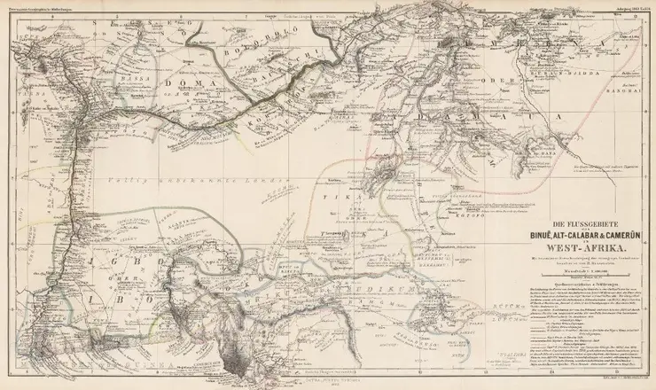
Colonial and Indigenous Statehood in the Maps of West Africa in the Gotha Perthes Collection, ca. 1817-1933
The research project analyzes the mapping of statehood in West Africa using the source material of the Perthes Collection in the Gotha Research Library. The map collection, the publisher's archive and the publisher's library provide information on how maps created, reflected, transformed and disseminated ideas of West African territoriality and state formation south of the Sahara.... more
Image: Bruno Hassenstein, Die Flussgebiete des Binue, Alt-Calabar & Kamerun in Westafrika, Mitteilungen aus Justus Perthes' Geographischer Anstalt (1863), plate 6 © Forschungsbibliothek/Sammlung Perthes.

